News:
Visit The Dick E. Bird News
Packtoters Blog
·WILD POLITICS
.NATIONAL PARK HIKING
· WORLD NEWS
.BuyingBooks,Gear and More at the AmazonOutdoorStore
· CONTINENTAL DIVIDE
· BACKPACKING GEAR
· ENVIRONMENTAL
· HIKING
· WALKING
· TRAVEL
· BOOKS
· NATIONAL PARKS
· BACKPACKING
. BACKPACKING LIGHT
. BACKPACKING TIPS
. TRAIL FOOD
· WILDERNESS NEWS
· QUOTES
. SCAT HAPPENS
· FUNNY PAGES
· WALKING FOR THE HEALTH OF IT
· RV LIFESTYLE
· BEAR STORIES
. ZIP ZTOVE
. TENT SITE
. LONG DISTANCE TRAIL NEWS
· PCT
· CDT
. CDT JOURNAL/TAKE THE HIKE
· AT
· AZT
· GDT
. GREAT WESTERN TRAIL
· ICE AGE TRAIL
. North Country Trail
. Y to Y
. FLORIDA TRAIL
. SUPERIOR TRAIL
. PNT
. VAGABOND
Sunday, August 17, 2008
Sunday, August 3, 2008
Rabid Bobcat Attacks Hikers Near Tucson

Two hikers were attacked by a rabid bobcat while hiking near Tucson, AZ. They were eventually able to kill it with a geologist’s hammer, but not before they both got pretty scratched up.
Rich Thompson said he knew the cat was rabid the moment he saw it staring at him and Katrina Mangin in the Santa Rita Mountains. He said they tried to get away but the bobcat pursued them, lunging at Mangin, climbing up her legs and wrapping its body around her, clawing and biting.
The couple fought off the bobcat, but it continued attacking and jumped on Thompson’s back. “I hit it with the backpack over my shoulder,” he said. The cat fell to the dirt and lunged again. “It attacked me again, and I threw it down.”
Rabid animals become desperate, mentally deranged, and dangerously aggressive. Rabies drove this normally reclusive bobcat literally insane by destroying its brain.
Health officials in the Tucson area said there have been an increase in rabies cases lately. No matter where you are, if you’re heading outdoors, you should be familiar with the signs of rabies. You should also know what to do if you’re bitten by an animal you think might be rabid.
Raccoons are the most likely wild animal to be infected by rabies, but no animal is safe from the disease. Skunks, foxes, bats, and coyotes often carry the virus as well. Big cats, like bobcats and mountain lions, are also susceptible.
There are two types of rabies, by the way: “furious” rabies and “paralytic” rabies according to the CDC. “Furious” rabies causes the animal to bite at everything and become very hostile, while the more common “paralytic” rabies causes confusion, paralysis, and timidity in the animals it infects.
How to Tell if an Animal Has Rabies:
1. Rabid animals often appear confused, insane, and/or aggressive.
2. If a nocturnal animal is out in the middle of the day, it could be rabid.
3. If a normally shy wild animal (like most of them) acts overly friendly, that may also be a sign of rabies infection.
4. Because rabid animals produce more saliva, they may appear to be foaming at the mouth.
5. An animal that is staggering, stunned, having trouble moving, or appears to be paralyzed, may have rabies.
Because it can be difficult to tell whether an animal is rabid or not (and for many other reasons), it’s wise to avoid any contact with animals in the wild.
If bitten by a rabid animal, the first thing you want to do is thoroughly wash the wound with soap and/or a virus-killing cleanser and water. Then get yourself or the bite victim to the nearest hospital for treatment. Don’t lose your cool — you need treatment immediately, but it’s not as urgent as a rattlesnake bite.
Monday, July 14, 2008
Bringing food canisters is a must for those backpacking

Exposure to human food is bad for bears on several levels.
The Fresno Bee
Nothing can ruin a backpacking trip like losing your food to a hungry bear.Bad for the backpacker. Even worse for the bear.Curious, intelligent and relentless, bears would rather eat trail mix or beef jerky than gnaw on a berry bush. But once they develop a taste for high-calorie human food, getting them back on a normal diet is next to impossible. "Once wild bears become habituated to human food, they cease to become wild bears," said Rob Mason, a Sierra National Forest wilderness manager. "And as they become habituated, they get more comfortable around people, which isn't good for us or them."
Decades ago, Sierra backpackers slept with their food to keep bears away. Not only did this method prove ineffective, it was also dangerous.
Then backpackers began hanging their food over a tree branch and tying the rope to a trunk. Once bears learned how to slash the rope with their claws, folks started employing a counter-balance technique in which no rope is tied to the trunk. While more effective, this method wasn't infallible. Bears eventually figured out how to bite through branches, shake tree trunks and even leap onto food bags from above.
"There have been documented incidents in Yosemite of bears doing a kamikaze-like jump onto the food from other branches and taking the pain from the fall because the reward is so significant," Mason said.
By the mid-1990s, wilderness officials began promoting the use of hard-sided portable containers See through Canister capable of fitting inside a backpack and storing several days worth of food. Try as they might, bears cannot break into these canisters if they are properly closed and secured.
Today, bear-proof canisters are required for all backpacking trips in Yosemite and in the popular Rae Lakes, Dusy Basin and Rock Creek areas of Sequoia and Kings Canyon. They even have small solo canisters available. They are "strongly recommended" for the rest of the park and also in the neighboring Sierra, Sequoia and Inyo national forests.
By next summer, canisters may be required throughout Sequoia and Kings Canyon, according to park wildlife ecologist Harold Werner. Canisters are widely available. Canisters come in variety of shapes, sizes and colors.
"Almost every bear incident we have in the backcountry involves food storage," Werner said.
Before they are approved for use, canisters are tested for ruggedness and durability on zoo bears and wild bears. A list of approved models can be found at the Sierra Interagency Black Bear Group's Web site, http://www.sierrawildbear.gov/.
Backpackers should use canisters to store not only food but also scented items such as sunscreen and toothpaste. They should be placed at least 100 feet from your campsite and away from water and cliffs.
"Bears are a curious and very intelligent species," Mason said. "Often what they'll do is wander into camp and knock over the canister because they know they can get to the food if the lid is off. If all else fails sleep with your food and the safety off on your bear spray.
"But if the lid is properly tightened, the bear usually will leave. Some bears don't even mess with them anymore."
Canisters can be purchased locally at sporting goods stores such as Herb Bauer and REI. Rentals are available at most frontcountry ranger stations.
Thursday, January 10, 2008
Big Agnes on the scene
The Amazon Outdoor Store
Sometimes ingenuity comes from the simplest of ideas. Such was the case for the breakthrough product of a Colorado backcountry gear company with Carbondale ties.A firm called Big Agnes managed in 2001 to squeeze into the camping gear industry by coming up with a revolutionary design for its sleeping bags.The product developers for the company, based in Steamboat Springs, were experienced backcountry travelers. They knew full well the frustration of thrashing around at night in a tent, slipping off a sleeping pad and paying the price by getting chilled to the bone.So they stripped the insulation from the bottom of their bags and replaced it with a sleeve that a sleeping pad slides into. That solves a couple of problems: first, sleepers don’t roll off their pads because it is integrated with their bags; second, there’s more guaranteed protection from the cold ground. The insulation on the bottom of a sleeping bag loses its warmth when a body compresses it. Their design replaces that insulation with a cushy pad. A person can go big with a 2 1/2inch pad when they are car camping or settle for a 1-inch when weight is an issue for backpacking. Pads made by other companies work with Big Agnes’ bags.Some of the insulation removed from the bottom of the sleeping bag was shifted elsewhere. But, overall, less insulation is used in Agnes bags so that means shedding weight without surrendering warmth.
Saturday, December 29, 2007
Moving Up
You can make the 10 essentials list an even dozen by adding rain gear and hiking poles.
If you are a fair-weather hiker, you are missing half the fun. While you stay inside where it's warm all winter, your favorite summer trails are taking on new personalities.
The deciduous trees have lost their leaves and are unveiling the views they blocked all summer. The traffic has thinned to the point where some trails can be had all to yourself.
"Plus, winter hikes keep you from getting depressed," said Jonathan Guzzo of the Washington Trails Association. "You are less likely to feel the burden of winter."
What's so great about hiking in the rain and cold?
"For me, it's all about that exercise in contrasts," Guzzo said. "It's about getting cold so you can get warm again after your hike. There's nothing better than changing into dry clothes and having a warm drink after a winter hike. It's a great feeling."
Here's what you need to know to get that feeling. Call it Winter Hiking 101.
Grab a lid and some gaiters: Wearing a hat is crucial to staying comfortable on a winter hike.
"If you cover your head, you're going a long way toward avoiding being miserable," Guzzo said.
Perhaps the only thing worse than a cold head is cold feet. Gaiters boot covers that keep out mud and debris are a good way to assure comfort.
"In the winter, mud on trails can be 8 to 9 inches deep," Guzzo said. "If you get mud and water in your boots, it's going to be a real bummer. I always wear gaiters."
Gorp: One of the best reasons for hiking is that you can justify eating things you shouldn't if you're playing couch potato all winter.
"Your body needs all kinds of food to stoke warmth," Guzzo said.
He recommends sweet foods for fast warmth, carbohydrates for prolonged warmth and fatty foods for the most warmth.
He suggests gorp (good old raisins and peanuts) or trail mix, a combination of candy, fruit and nuts.
"If you take a lot of gorp, it will help you keep warm," Guzzo said.
The 12 essentials: No hiker should hit the trail without the 10 essentials, but especially in winter, Nos. 11 and 12 should be added to the famous outdoorsman checklist.
Robert Mooers, author of "Winter Hikes in Puget Sound and the Olympic Foothills," is big on adding rain gear to the list.
"How rain gear didn't make it on the 10 essentials list I'll never know," Mooers said. "It's vital in winter."
Mooers says to also pay special attention to packing extra clothes.
"If you break an ankle and have to spend the night outdoors in the summer, you probably only have to worry about temperatures in the 40s," Mooers said. "In the winter, you could freeze."
Mooers also recommends taking a hiking pole for traveling over possible icy portions of the trail.
"It's like having a third leg," Mooers said. "It's really helpful, especially going downhill."
No. 12 should be the cell phone – not to be used to chat while you hike, but in case of emergency. If you or somebody in your party needs medical attention and you can get cell phone service in your remote location, it could improve the odds of rescue.
Here are the 10 essentials on the regular checklist:
1. Map
2. Compass and the ability to use it
3. Sunglasses and sunscreen
4. Extra food and water
5. Extra clothes
6. Flashlight
7. First-aid kit
8. Matches or lighter
9. Fire starter
10. Knife
Cotton kills: In the summer, even the hard-core hiker will occasionally sneak out for a quick hike in a cotton shirt.
Don't be so bold in fall and winter months.
"Never, ever, ever, ever wear cotton in the winter," Guzzo said.
Cotton clothes don't wick sweat away from your body, don't retain body heat and don't dry very quickly.
At best, this will leave you miserable if you encounter rain or snow. At worst, cotton clothes will put you on the fast track to hypothermia.
Instead, read the labels and layer up with materials such as Gore-Tex, fleece, wool, polyester, spandex and nylon.
You don't have to wear all the clothes at once. You'll need fewer clothes when you're moving, but you'll be happy you carried that heavier layer to keep you warm when you stop for lunch.
Save yourself: It seems that every winter, a hiker or two makes news by losing the trail in the snow and getting lost. Some are rescued. Some are not.
Don't be one of those people, Mooers says. "When you can no longer identify the trail because of snow, it's time to go back."

Winter hikes an exercise in contrasts
By Craig Hill
You can make the 10 essentials list an even dozen by adding rain gear and hiking poles.
If you are a fair-weather hiker, you are missing half the fun. While you stay inside where it's warm all winter, your favorite summer trails are taking on new personalities.
The deciduous trees have lost their leaves and are unveiling the views they blocked all summer. The traffic has thinned to the point where some trails can be had all to yourself.
"Plus, winter hikes keep you from getting depressed," said Jonathan Guzzo of the Washington Trails Association. "You are less likely to feel the burden of winter."
What's so great about hiking in the rain and cold?
"For me, it's all about that exercise in contrasts," Guzzo said. "It's about getting cold so you can get warm again after your hike. There's nothing better than changing into dry clothes and having a warm drink after a winter hike. It's a great feeling."
Here's what you need to know to get that feeling. Call it Winter Hiking 101.
Grab a lid and some gaiters: Wearing a hat is crucial to staying comfortable on a winter hike.
"If you cover your head, you're going a long way toward avoiding being miserable," Guzzo said.
Perhaps the only thing worse than a cold head is cold feet. Gaiters boot covers that keep out mud and debris are a good way to assure comfort.
"In the winter, mud on trails can be 8 to 9 inches deep," Guzzo said. "If you get mud and water in your boots, it's going to be a real bummer. I always wear gaiters."
Gorp: One of the best reasons for hiking is that you can justify eating things you shouldn't if you're playing couch potato all winter.
"Your body needs all kinds of food to stoke warmth," Guzzo said.
He recommends sweet foods for fast warmth, carbohydrates for prolonged warmth and fatty foods for the most warmth.
He suggests gorp (good old raisins and peanuts) or trail mix, a combination of candy, fruit and nuts.
"If you take a lot of gorp, it will help you keep warm," Guzzo said.
The 12 essentials: No hiker should hit the trail without the 10 essentials, but especially in winter, Nos. 11 and 12 should be added to the famous outdoorsman checklist.
Robert Mooers, author of "Winter Hikes in Puget Sound and the Olympic Foothills," is big on adding rain gear to the list.
"How rain gear didn't make it on the 10 essentials list I'll never know," Mooers said. "It's vital in winter."
Mooers says to also pay special attention to packing extra clothes.
"If you break an ankle and have to spend the night outdoors in the summer, you probably only have to worry about temperatures in the 40s," Mooers said. "In the winter, you could freeze."
Mooers also recommends taking a hiking pole for traveling over possible icy portions of the trail.
"It's like having a third leg," Mooers said. "It's really helpful, especially going downhill."
No. 12 should be the cell phone – not to be used to chat while you hike, but in case of emergency. If you or somebody in your party needs medical attention and you can get cell phone service in your remote location, it could improve the odds of rescue.
Here are the 10 essentials on the regular checklist:
1. Map
2. Compass and the ability to use it
3. Sunglasses and sunscreen
4. Extra food and water
5. Extra clothes
6. Flashlight
7. First-aid kit
8. Matches or lighter
9. Fire starter
10. Knife
Cotton kills: In the summer, even the hard-core hiker will occasionally sneak out for a quick hike in a cotton shirt.
Don't be so bold in fall and winter months.
"Never, ever, ever, ever wear cotton in the winter," Guzzo said.
Cotton clothes don't wick sweat away from your body, don't retain body heat and don't dry very quickly.
At best, this will leave you miserable if you encounter rain or snow. At worst, cotton clothes will put you on the fast track to hypothermia.
Instead, read the labels and layer up with materials such as Gore-Tex, fleece, wool, polyester, spandex and nylon.
You don't have to wear all the clothes at once. You'll need fewer clothes when you're moving, but you'll be happy you carried that heavier layer to keep you warm when you stop for lunch.
Save yourself: It seems that every winter, a hiker or two makes news by losing the trail in the snow and getting lost. Some are rescued. Some are not.
Don't be one of those people, Mooers says. "When you can no longer identify the trail because of snow, it's time to go back."
Wednesday, December 26, 2007
SECTION HIKING THE AT

Hiker Charles Rohrbacher stands atop Mount Washington. At 6,288 feet, it is the highest peak along the Appalachian Trail.
Three pairs of boots, nine years and 2,175 miles later, Charles Rohrbacher did it; he finally finished hiking the Appalachian Trail. Hiking segments on the trail during six summers, Rohrbacher finally stood atop Mount Katahdin in Maine on July 14 this year and claimed victory. "I had enjoyed hiking during my 19 years with the Boy Scouts and what inspired me to finish the trail was when a former student, Ryan Schmit, completed it in 2006," Rohrbacher said. Rohrbacher, who is a High School business teacher, only had time to hike during some summers when he first started his odyssey in 1998 from Springer Mountain, Ga., to Hot Springs, N.C. The idea for a national hiking trail was first conceived in 1921 and was finally completed in 1938 with the assistance of the Civilian Conservation Corps. The Appalachian Trail stretches through 14 states, Georgia, North Carolina, Tennessee, Virginia, West Virginia, Maryland, Pennsylvania, New Jersey, New York, Connecticut, Massachusetts, Vermont, New Hampshire and Maine. Rohrbacher hit the trail again during the summers of 2000, 2001, 2003, 2005 and 2007. Averaging approximately 10-15 miles a day, he found the last 100 miles were the most remote, had difficult terrain and weather and it was harder to find a place to sleep. "There are shelters every 8-10 miles but some are small and primitive. I’d check my trail guide and if there was a town close, I’d hitchhike and find a laundry, groceries, and place to shower and sleep," he said. Obviously not able to pack food for three weeks in an already stuffed 30-to-40-pound backpack, Rohrbacher also relied on family and friends who mailed food packages for him to post offices along his hiking route. And then there were the "trail angels," local friendly residents who would bring trail hikers cookies and other goodies to brighten their day. Rohrbacher saw quite a bit of history during his hike; Harper’s Ferry, a 300-year-old stone monument to George Washington, the site where Audie Murphy’s plane crashed, the nation’s largest tree in girth and Dartmouth College where the trail goes right through the campus. He also saw his fair share of deer, moose and bears but didn’t have encounters with any. "In the Smokey Mountains they have chain-link fencing around the shelters so the bears can’t get in," he explained. Rohrbacher said the north portion of the Trail through New Hampshire and Maine is the most arduous. "There are warnings of the dangers for inexperienced hikers. There are also some rivers that have to be crossed and a marker at one place requires hikers to be ferried across by canoe," he explained. On a lighter note he mentioned a remote restaurant on an island that could only be reached by boat. "There is an air horn on the dock and when you sound it, they send a boat to pick you up. Some people complained about the food prices but it was good and it was the only place to eat for miles," he laughed. After finally achieving his hiking goal, would he do it again? Rohrbacher simply said, "I’m glad I did it and I would do it again."
http://thenewspaperthatwalks.com/
Thursday, December 20, 2007
Continental Divide Trail/Red Desert--Great Basin

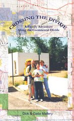
Crossing Wyomings Great Basin Along the Continental Divide Trail:
As it turned out, the dragon was fairly tame. I had given much more thought to the Great Basin than was necessary. I left Wamsutter, Wyoming, with two gallons of water and my purifier. I made the crossing in three days and found plenty of water along the way. My original plan was to head straight north from Wamsutter until I reached a junction with the official CDT route and follow the trail west to Atlantic City. An hour after I left Wamsutter, I was still considering other options. According to my map, the Hay Reservoir was off to the northwest which held the promise of water and a much more direct route to Atlantic and South Pass City. Shortcuts do not always work out the way you plan them. I considered the Donner Party and their peril as they took the shortcut through the Sierras in the 1800s—one good reason not to deviate from my original plan worked out with the Bureau of Land Management staff. But in this case, my original plan had no more merit than any other cockamamie idea I could come up with. I decided to take the shortest route to the Sweetwater River, the only water source I knew I could rely on.
Because of gas exploration and development in the lower Basin, there are roads going in every direction. Even here in this remote and barren moonscape, the Earth seems in chaos, dealing with the constant onslaught of man. When in doubt which road to take, I pulled out my GPS and cut across the sagebrush until I junctioned with a road that seemed to be going in the same direction that I was. Even though I had not seen a rattlesnake in over two months of hiking, I kept thinking about my breakfast tutor and looking for serpents on top of each of the million plants I brushed.
The second morning, I found a flowing well at Lost Creek Fork. By noon I ate lunch near the Hay Reservoir, and, though it was dried up, I found enough puddles to pump water through my purifier and wash down my cheese tortilla. The morning of my third day, I passed Scotty Lake which was not saline as I had been told and there was plenty of water. At this point I cut cross country and north around the west side of Picket Lake to reach the Forks-Atlantic City Rd., a two-track which would lead to South Pass City. During the afternoon, I came across another flowing well near a stock tank. By evening, I was sitting on the shore of the Sweetwater River, drinking my fill. Because of cloudy overcast days with sprinkles now and then, I was able to hike thirty plus miles each day, reaching the trail to South Pass City on the third day.
For me, the Great Basin was a quiet land of solitude with its own magical landscape. I sat in the ruts of the Oregon Trail and looked back over the terrain and time. I realized, once again, that knowledge and experience turn fears into facts, dragons into friends.
For nearly a hundred miles, I could see the Wind River range to the northwest. It seemed like an oasis to be reached, rewarding me for crossing this dry alkali basin. I could see rain from the Winds dissipate as it was blown across the basin.
Subscribe to:
Posts (Atom)