Saturday, December 29, 2007

Moving Up
Winter hikes an exercise in contrasts


By Craig Hill


You can make the 10 essentials list an even dozen by adding rain gear and hiking poles.


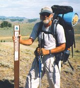
If you are a fair-weather hiker, you are missing half the fun. While you stay inside where it's warm all winter, your favorite summer trails are taking on new personalities.
The deciduous trees have lost their leaves and are unveiling the views they blocked all summer. The traffic has thinned to the point where some trails can be had all to yourself.
"Plus, winter hikes keep you from getting depressed," said Jonathan Guzzo of the Washington Trails Association. "You are less likely to feel the burden of winter."
What's so great about hiking in the rain and cold?
"For me, it's all about that exercise in contrasts," Guzzo said. "It's about getting cold so you can get warm again after your hike. There's nothing better than changing into dry clothes and having a warm drink after a winter hike. It's a great feeling."
Here's what you need to know to get that feeling. Call it Winter Hiking 101.
Grab a lid and some gaiters: Wearing a hat is crucial to staying comfortable on a winter hike.
"If you cover your head, you're going a long way toward avoiding being miserable," Guzzo said.
Perhaps the only thing worse than a cold head is cold feet. Gaiters boot covers that keep out mud and debris are a good way to assure comfort.
"In the winter, mud on trails can be 8 to 9 inches deep," Guzzo said. "If you get mud and water in your boots, it's going to be a real bummer. I always wear gaiters."
Gorp: One of the best reasons for hiking is that you can justify eating things you shouldn't if you're playing couch potato all winter.
"Your body needs all kinds of food to stoke warmth," Guzzo said.
He recommends sweet foods for fast warmth, carbohydrates for prolonged warmth and fatty foods for the most warmth.
He suggests gorp (good old raisins and peanuts) or trail mix, a combination of candy, fruit and nuts.
"If you take a lot of gorp, it will help you keep warm," Guzzo said.
The 12 essentials: No hiker should hit the trail without the 10 essentials, but especially in winter, Nos. 11 and 12 should be added to the famous outdoorsman checklist.
Robert Mooers, author of "Winter Hikes in Puget Sound and the Olympic Foothills," is big on adding rain gear to the list.
"How rain gear didn't make it on the 10 essentials list I'll never know," Mooers said. "It's vital in winter."
Mooers says to also pay special attention to packing extra clothes.
"If you break an ankle and have to spend the night outdoors in the summer, you probably only have to worry about temperatures in the 40s," Mooers said. "In the winter, you could freeze."
Mooers also recommends taking a hiking pole for traveling over possible icy portions of the trail.
"It's like having a third leg," Mooers said. "It's really helpful, especially going downhill."
No. 12 should be the cell phone – not to be used to chat while you hike, but in case of emergency. If you or somebody in your party needs medical attention and you can get cell phone service in your remote location, it could improve the odds of rescue.
Here are the 10 essentials on the regular checklist:
1. Map
2. Compass and the ability to use it
3. Sunglasses and sunscreen
4. Extra food and water
5. Extra clothes
6. Flashlight
7. First-aid kit
8. Matches or lighter
9. Fire starter
10. Knife
Cotton kills: In the summer, even the hard-core hiker will occasionally sneak out for a quick hike in a cotton shirt.
Don't be so bold in fall and winter months.
"Never, ever, ever, ever wear cotton in the winter," Guzzo said.
Cotton clothes don't wick sweat away from your body, don't retain body heat and don't dry very quickly.
At best, this will leave you miserable if you encounter rain or snow. At worst, cotton clothes will put you on the fast track to hypothermia.
Instead, read the labels and layer up with materials such as Gore-Tex, fleece, wool, polyester, spandex and nylon.
You don't have to wear all the clothes at once. You'll need fewer clothes when you're moving, but you'll be happy you carried that heavier layer to keep you warm when you stop for lunch.
Save yourself: It seems that every winter, a hiker or two makes news by losing the trail in the snow and getting lost. Some are rescued. Some are not.
Don't be one of those people, Mooers says. "When you can no longer identify the trail because of snow, it's time to go back."

Wednesday, December 26, 2007

SECTION HIKING THE AT


Hiker Charles Rohrbacher stands atop Mount Washington. At 6,288 feet, it is the highest peak along the Appalachian Trail.


Three pairs of boots, nine years and 2,175 miles later, Charles Rohrbacher did it; he finally finished hiking the Appalachian Trail. Hiking segments on the trail during six summers, Rohrbacher finally stood atop Mount Katahdin in Maine on July 14 this year and claimed victory. "I had enjoyed hiking during my 19 years with the Boy Scouts and what inspired me to finish the trail was when a former student, Ryan Schmit, completed it in 2006," Rohrbacher said. Rohrbacher, who is a High School business teacher, only had time to hike during some summers when he first started his odyssey in 1998 from Springer Mountain, Ga., to Hot Springs, N.C. The idea for a national hiking trail was first conceived in 1921 and was finally completed in 1938 with the assistance of the Civilian Conservation Corps. The Appalachian Trail stretches through 14 states, Georgia, North Carolina, Tennessee, Virginia, West Virginia, Maryland, Pennsylvania, New Jersey, New York, Connecticut, Massachusetts, Vermont, New Hampshire and Maine. Rohrbacher hit the trail again during the summers of 2000, 2001, 2003, 2005 and 2007. Averaging approximately 10-15 miles a day, he found the last 100 miles were the most remote, had difficult terrain and weather and it was harder to find a place to sleep. "There are shelters every 8-10 miles but some are small and primitive. I’d check my trail guide and if there was a town close, I’d hitchhike and find a laundry, groceries, and place to shower and sleep," he said. Obviously not able to pack food for three weeks in an already stuffed 30-to-40-pound backpack, Rohrbacher also relied on family and friends who mailed food packages for him to post offices along his hiking route. And then there were the "trail angels," local friendly residents who would bring trail hikers cookies and other goodies to brighten their day. Rohrbacher saw quite a bit of history during his hike; Harper’s Ferry, a 300-year-old stone monument to George Washington, the site where Audie Murphy’s plane crashed, the nation’s largest tree in girth and Dartmouth College where the trail goes right through the campus. He also saw his fair share of deer, moose and bears but didn’t have encounters with any. "In the Smokey Mountains they have chain-link fencing around the shelters so the bears can’t get in," he explained. Rohrbacher said the north portion of the Trail through New Hampshire and Maine is the most arduous. "There are warnings of the dangers for inexperienced hikers. There are also some rivers that have to be crossed and a marker at one place requires hikers to be ferried across by canoe," he explained. On a lighter note he mentioned a remote restaurant on an island that could only be reached by boat. "There is an air horn on the dock and when you sound it, they send a boat to pick you up. Some people complained about the food prices but it was good and it was the only place to eat for miles," he laughed. After finally achieving his hiking goal, would he do it again? Rohrbacher simply said, "I’m glad I did it and I would do it again."
http://thenewspaperthatwalks.com/

Thursday, December 20, 2007

Continental Divide Trail/Red Desert--Great Basin


Crossing Wyomings Great Basin Along the Continental Divide Trail:


As it turned out, the dragon was fairly tame. I had given much more thought to the Great Basin than was necessary. I left Wamsutter, Wyoming, with two gallons of water and my purifier. I made the crossing in three days and found plenty of water along the way. My original plan was to head straight north from Wamsutter until I reached a junction with the official CDT route and follow the trail west to Atlantic City. An hour after I left Wamsutter, I was still considering other options. According to my map, the Hay Reservoir was off to the northwest which held the promise of water and a much more direct route to Atlantic and South Pass City. Shortcuts do not always work out the way you plan them. I considered the Donner Party and their peril as they took the shortcut through the Sierras in the 1800s—one good reason not to deviate from my original plan worked out with the Bureau of Land Management staff. But in this case, my original plan had no more merit than any other cockamamie idea I could come up with. I decided to take the shortest route to the Sweetwater River, the only water source I knew I could rely on.
Because of gas exploration and development in the lower Basin, there are roads going in every direction. Even here in this remote and barren moonscape, the Earth seems in chaos, dealing with the constant onslaught of man. When in doubt which road to take, I pulled out my GPS and cut across the sagebrush until I junctioned with a road that seemed to be going in the same direction that I was. Even though I had not seen a rattlesnake in over two months of hiking, I kept thinking about my breakfast tutor and looking for serpents on top of each of the million plants I brushed.
The second morning, I found a flowing well at Lost Creek Fork. By noon I ate lunch near the Hay Reservoir, and, though it was dried up, I found enough puddles to pump water through my purifier and wash down my cheese tortilla. The morning of my third day, I passed Scotty Lake which was not saline as I had been told and there was plenty of water. At this point I cut cross country and north around the west side of Picket Lake to reach the Forks-Atlantic City Rd., a two-track which would lead to South Pass City. During the afternoon, I came across another flowing well near a stock tank. By evening, I was sitting on the shore of the Sweetwater River, drinking my fill. Because of cloudy overcast days with sprinkles now and then, I was able to hike thirty plus miles each day, reaching the trail to South Pass City on the third day.
For me, the Great Basin was a quiet land of solitude with its own magical landscape. I sat in the ruts of the Oregon Trail and looked back over the terrain and time. I realized, once again, that knowledge and experience turn fears into facts, dragons into friends.
For nearly a hundred miles, I could see the Wind River range to the northwest. It seemed like an oasis to be reached, rewarding me for crossing this dry alkali basin. I could see rain from the Winds dissipate as it was blown across the basin.

Tuesday, December 11, 2007

BACKPACKER FOOD FOR THOUGHT


Mountain House, the leading seller of prepackaged backpacker meals, has been using freeze-drying to remove moisture from its meals since its parent company, Oregon Freeze Dry Inc., began selling long-range patrol rations to the military during the Vietnam War.

FLORIDA'S FANTASTIC FORESTS


With more than one million acres of undeveloped wilderness, Florida’s 31 state forests are a veritable playground for backpackers, birders, paddlers and cyclists.By Terry Tomalin
Withlacoochee State ForestOn a cool morning in late October, an eerie mist rises over the sandhill scrub in the Citrus Tract of the Withlacoochee State Forest. As the first rays of sunlight filter through the pine trees, a thunder of wings echoes the woods.“Whoo! Whoo-whoo-whoo!” the great bird cries. “Whoo! Whoo!”The horned owl, one of the forest’s great hunters, is returning from its nocturnal work. We sit quietly and wait, hoping to catch a glimpse of the mysterious bird. Then, after a few minutes of awkward silence, we are rewarded when the owl takes flight again, its five-foot wingspan casting a shadow on the forest floor.It is moments such as this that brings us back, again and again, to Florida’s fabulous state forests. I have spent many long days wandering along empty, tree-lined trails, with birds, deer and wild hog my only companions. These vast, publicly-owned lands are one of the state’s best- kept secrets.